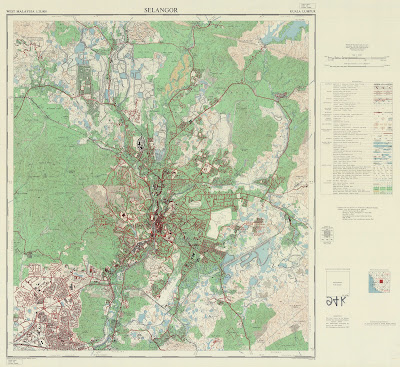
This blog post hosts and will host historical maps of Kuala Lumpur over the years
The maps embedded in the blog post are a sneak preview of the full-scale map.
1957 Map
For optimum viewing: https://drive.google.com/file/d/1zmiLzOFpzlumVQKWWv-9SVjRynp8xXAX/view?usp=drive_linkSource: University of Wisconsin-Milwaukee Libraries
1965 Map
For optimum viewing: https://drive.google.com/file/d/1l0KBdmNZXjvsN16uEKYXms9sc2-Onlwg/view?usp=sharing
Source: University of Wisconsin-Milwaukee Libraries
1967 Map (Kuala Lumpur and Petaling Jaya)
For Optimum Viewing:
Source: The Australian National University (Open Research Repository)
1973 Map
For optimum viewing: https://drive.google.com/file/d/1eoGqjxXwKE0z15OJCKlJ0fTzTlLiqdBV/view?usp=drive_link
Source: The Australian National University (Open Research Repository)
1982 Map
For optimum viewing:
Source: University of Wisconsin-Milwaukee Libraries
1993 Map
For accessible viewing:
Alternate Site: https://klmap1993.my.canva.site/
Recommend to have associated PDF reader for detailed inspection
Source: Private Collection of Danesh Prakash Chacko
2003 Map
For optimum viewing:
Source: University of Wisconsin-Milwaukee Libraries


.jpg)
